The study takes place near the northern coast of the state of Yucatan
in Mexico. From disturbed and pristine deciduous tropical forest to lowland,
seasonally flooded, coastal forest, the land is either privately owned,
community owned or government managed.
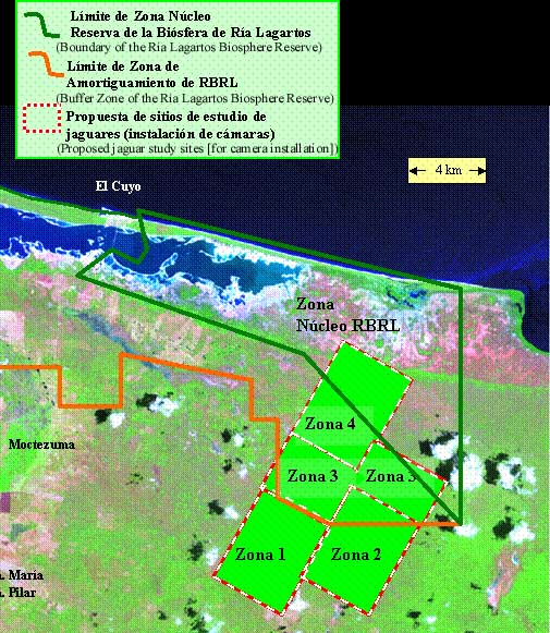
Each Zona on the map below will have camera traps sited in it for a period of four to five weeks.
Data will be assembled and analyzed after the field season (February through June) to estimate population density of jaguars in the region and to determine potential next steps in developing long-term partnerships among stakeholders for land and wildlife conservation.
map courtesy of, and © PRONATURA Peninsula de Yucatan
Click
below to view sample photgraphs and brief descriptions from each of the
study zones.