The study takes place near the northern coast of the state of Yucatan
in Mexico. From disturbed and pristine deciduous tropical forest to lowland,
seasonally flooded, coastal forest, the land is either privately owned,
community owned or government managed.
In 2005 the camera trapping pattern was adapted to follow methods successfully used by researchers in Belize and Bolivia. The hexagonal study grid permited us to cover more area with a similar probability of photographing jaguars. It also kept the project team from having to shift cameras every five weeks.
In 2005 the camera trapping pattern was adapted to follow methods successfully used by researchers in Belize and Bolivia. The hexagonal study grid permited us to cover more area with a similar probability of photographing jaguars. It also kept the project team from having to shift cameras every five weeks.
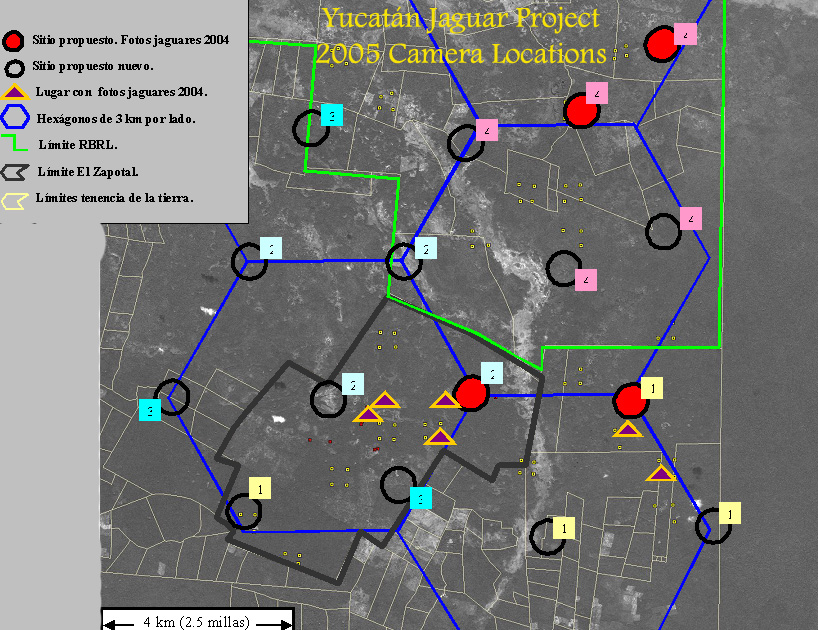
map courtesy of, and © PRONATURA Peninsula de Yucatan
Red
circles are camera sites repeated from 2004. Open black circles are new
sites. Gold triangles are 2004 sites where jaguars were photographed.
Each blue
hexagon side is 3km (1.8 miles) long.
To view photos, click a time-frame
below.
The first hurricane
struck Yucatán in July, so all cameras were pulled and the season
suspended at that time.